194 results
- Books
- Online
The universal pocket-book; being the most comprehensive, useful, and compleat book of the kind, ever yet publish'd: containing, amongst a great many other Particulars, I. A map of the world, with a Geographical Description of the same. II. An Historical Table of remarkable Events, from the Creation to Julius Caesar. III. A Map of England, with an Account of the Number of Parishes, Market-Towns, Market-Days, Cities, Bishopricks, &c. IV. A List of the House of Peers, with their Names, Titles, Mottos, Town-House and Country-House. V. A short abstract of the History of England. VI. The Gardener's Instructor, or the Method of managing to the greatest Perfection, the best and most useful Products of the Fruit, Flower, and Kitchen Gardens. Vii. The four Rules of Arithmetic explain'd in so easy and familiar a Manner, that they may be learn'd without a Master. Viii. Short Definitions of all the Arts and Sciences. IX. An Account of all the Companies in London. X. Of the General and Penny-Post. XI. A New Perpetual Almanack. XII. The Prices of the different Works, of Bricklayers, Masons, Joiners, Carpenters, Plumbers, Slaters, Painters, Plaisterers, Paviors, Smiths, Carvers, &c. XIII. Tables of all the Modern Coins of Europe, with their Value in English Money. XIV. A New Plan of the City of London, with a Description of whatever is remarkable. XV. An Account of all the Stage-Coaches, and Carriers in England and Scotland. XVI. A list of places at court, with their salaries and in whose gift. The whole Design'd for the Use, Benefit, and Convenience of all Sorts of Persons.
Date: 1740- Books
- Online
A journey from London to France and Holland: or, the traveller's useful vade mecum. ... . Wherein is contain'd the following Particulars, viz. I. Each Day's Observation, in Travelling from London to Paris, thro' French Flanders. II. And from thence to Reims. III. The Manner of Examination mention'd, for obtaining a Diploma in Physick, at that University. IV. A Copy of the Diploma itself. V. A Comparison between the City of Paris and London. VI. Some Account of Paris, Theinhabitants, and the Buildings thereof. Vii. A Description of the two Famoushospitals there,viz. Thehotel Dieu, and La Charity. Viii. An Account of Versailles and its Gardens, &c. IX. An Account of a Course of Midwifry, &c. at Paris. X. An Account of Thefrench Money to a Hundred Million of Livres, with a Copperplate of its Impression on each Side, and a Table reducing it into English Money. XI. The Grounds of the French Language, &c. XII. A Short, Historical, Geographical Account of the Nation and People. XIII. A List of the Posts throughout the whole Kingdom of France, shewing the Distance of Places one from the other, and the Number of Posts therein contain'd, &c. XIV. To the Whole is added Maps of the Cities of London and Paris, with the Names of the Streets, &c. contain'd therein. The Whole is calculated and design'd chiefly for the Use and Benefit of Travellers going into that Kingdom, whereby fully to inform them of those Parts of Knowledge needful hereto: Wherein is also occasionally contain'd many Moral Reflections and Useful Observations. By R. Poole, Doctor of Physick.
Poole, R. (Robert), 1708-1752.Date: M.DCC.L. [1750]- Books
- Online
A journey from London, to France and Holland: or, the traveller's useful vade mecum. ... . Wherein is contain'd the following Particulars, viz. I. Each Day's Observations, in Travelling from London to Paris, through French Flanders. II. And from thence to Reims. III. The Manner of Examination mention'd, for obtaining a Diploma in Physick, at that University. IV. A Copy of the Diploma itself. V. A Comparison between the City of Paris and London. VI. Some Account of Paris, the Inhabitants, and the Buildings thereof. Vii. A Description of the two samous Hospitals there, viz the Hotel Dieu, and La Charity. Viii. An Account of Versailles, and its Gardens, &c. IX. An Account of a Course of Midwifry, &c. at Paris. X. An Account of the French Money, to a Hundred Million of Livies, with a Copper Plate of its Impression on each Side, and a Table reducing it into English Money. XI. The Grounds of the French Language, &c. XII. A Short, Historical, Geographical Account of the Nation and People. XIII. A List of the Posts throughout the whole Kingdom of France, shewing the Distance of Place one from the other and the Number of Posts therein contain'd, &c. XIV. To the Whole is added Maps of the Cities of London and Paris, with the Names of the Streets, &c. contain'd therein. The Whole is calculated and design'd chiefly for the Use and Benefit of travellers going into that Kingdom, whereby fully to inform them of those Parts of Knowledge needful hereto: Wherein is also occasionally contain'd many Moral Reflections and Useful Observations. The second edition. By R. Poole Doctor of Physick.
Poole, R. (Robert), 1708-1752.Date: M.DCC.XLVI. [1746]- Books
Names and their histories : alphabetically arranged as a handbook of historical geography and topographical nomenclature / by Isaac Taylor.
Taylor, Isaac, 1829-1901.Date: 1896- Books
- Online
The new London spelling book. Or the young gentleman's and lady's guide to the English tongue. In five parts. I. For Beginners, shewing a natural and easy Method to pronounce and express both common Words and proper Names, gradually ascending from One to Six Syllables, properly distinguished by Tables. Together with easy Lessons, placed at the End of each Table, for the more speedy way of teaching Children to read. Also is added, a few Lessons on various Subjects in Verse; with Rules and Maxims of moral Conduct, &c. and may be spoke extempore on breaking-up. II. A Table of Words, that are the same or nearly alike in Sound but different in Signification and in Spelling; in which the Scholar should be made perfect, to spell without Book, to prevent the writing one Word for another. III. Directions for an agreeable Behaviour and polite Address; with a Table of Words, properly accented for Exercise in Spelling. IV. Lessons on various Subjects, in Prose and Verse. V. A plain and compendious Grammar, with Rules for spelling and dividing Words into Syllables; the Use of Stops, Marks, and Capitals; Rules for reading with Elegance and Propriety; Tables of Abbreviations, the Multiplication and Pence Tables; to which is added, the Church Catechism. In the whole of which great Care has been taken to collect what might teach Youth their Duty and Behaviour towards God and Man, and is recommended by several eminent Schoolmasters as the most useful Performance for the Instruction of Youth extant, as it will enable the Teacher to instruct his Scholars to read with Propriety, without the Assistance of any other Book. The tenth edition, corrected and improved. By Charles Vyse, Author of the Tutor's Guide; the Key to the Tutor's Guide; a New Geographical Grammar, for the Use of Schools; the Ladies Accomptant, &c.
Vyse, Charles, active 1770-1815.Date: MDCCXCI. [1791]- Books
Place names of the world : historical context, meanings and changes. [Vol. 1], Europe / John Everett-Heath.
Everett-Heath, John.Date: 2000
- Books
- Online
Vulgar errors, ancient and modern, attributed as imports to the proper names of the globe ... investigating the origin and uses of letters ... Biblical long-lost names--unknown names of heathen gods, of nations, provinces, towns &c. With a critical disquisition on every station of Richard of Cirencester and Antoninus in Britain ... To which is added, Richard's [i.e. C.J. Bertram's] original work / [G. Dyer].
Dyer, G. (Gilbert), 1743-1820.Date: 1816- Books
Die medizinhistorische Deutung des Namens 'Rosstrae̊' in Aachen / Egon Schmitz-Cliever.
Schmitz-Cliever, Egon, 1913-Date: 1968
- Books
- Online
Orbis latinus : oder Verzeichnis der wichtigsten lateinischen Orts- und Ländernamen / von J.G. Th. Graesse.
Grässe, Johann Georg Theodor, 1814-1885.Date: 1909- Books
- Online
A new description of Europe in various columns, whereby is exhibited at one view. I. All its empires, kingdoms, republics and states; their situation, 1. From the Center of Europe in the first Column, which we fix at Cracow, in Poland; and, 2. from London, as observed in the 4th Column; also their Length, Breadth, Divisions, Inhabitants, Religion, ancient Names, Neighbours, Metropolis, Titles, Situation, whether on Rivers or Seas, &c. and Provinces; their Latitude and Longitude, Coronation Place, longest Day, difference of Time, Distance and Bearing from London; Climate, their Antipodes, the Time of High Water at some Places, with other useful Observations, Likewise other large Cities of the second Magnitude, with their Titles, Latitude, &c. Also remarkable Rivers, Mountains, Volcanos, Lakes, Gulphs, Bays, Streights, Capes, &c. Secondly, The present Sovereigns, their Age, and the Year of Accession; the Heirs Apparent, and their Age; eight of the immediate Predecessors, with the Year of their Accession, and the different Orders of Knighthood, and when instituted. Thirdly, The chief Produce, Manufactures, &c. And, Fourthly, Short Accounts of the various Countries, as Outlines of the History, and of the best English and French Authors, who have treated on this Subject. To which is Added, A very copious List of all the Cities and Towns of every Empire, Kingdom and State, in Europe, with their different Titles, Magnitudes, remarkable Events, and other useful and curious Remarks, in Abbreviations and Characteristics; after a Method entirely new, and never before published. At the End of this Work, is added a variety of very useful Tables, with other Observations. The Whole, being Multum in Parvo, is composed, calculated, and compiled, from the best Authors, By J.S. Charrier, Teacher of Geography, the Use of the Globes, the French Language, &c. Author of the Chorographical Description of England and Wales, the Geographical Table of noted Cities, improver and editor of Dr. Nugent's Pocket Dictionary, French and English, &c.
Charrier, J. Samuel.Date: 1781- Books
- Online
Proposals for printing and publishing by subscription, correct maps of the rivers Rhine, Maese, and Scheldt, Dedicated, BY Permission, To His Royal Highness The Duke Of AtYork. First ----- A complete Set of five Maps of the River Rhine, being 672 Miles. No. 1. From its Spring to Basle, being 216 Miles. No. 2. From Basle to Strasbourgh and Fort Lewis, being 87 Miles. No. 3. From Fort Lewis to Mentz, being 109 Miles. No. 4. From Mentz to Dusseldorff, being 133 Miles. No. 5. From Dusseldorff to Wych, being 127 Miles. Secondly. A complete Set of Four Maps of the River Maese, being 645 Miles. No. 1. From its Spring to Verdun, being 164 Miles. No. 2. Verdun to Dinant, being 189 Miles. No. 3. From Dinant to Venlo, being 183 Miles. No. 4. From Venlo to the Sea, being 139 Miles. Thirdly, A complete Map of the River Scheldt, from Bouchain to the Sea, being 229 Miles. To each of these Maps is given, in large Marginal Notes, a Geographical Description of the above Rivers, together with all the Cities, Fortifications, and other remarkable Places situated on their Borders, with the Names of the several Sovereigns to whom they belonged, previous to the present War. The whole taken and surveyed by Matthias Koops, Esq. Who for several Years served in different distinguished Military Characters, under the late Emperor of Germany, and King of Prussia. Conditions. The Maps will be finished and ready for delivery to the Subscribers the First Day of June next. The Maps to be printed and elegantly coloured, on the largest wove Imperial Paper, 26in. by 39. The Subscription for the Ten Maps, is Ten Guineas, one half to be paid at the Time of Subscribing, and the remainder, on Delivery. Subscriptions are received by Messrs. Hammersley and Co. Pall-Mall. N. B. No more Copies will be printed than subscribed for.
Koops, Matthias.Date: 1796]- Books
Dictionary of Pāli proper names / by G.P. Malalasekera.
Malalasekera, G. P. (Gunapala Piyasena), 1899-1973.Date: 1974-
- Books
- Online
Court hand restored; or the student's assistant in reading old deeds, charters, etc. With an appendix; containing the ancient names of places in Great Britain and Ireland; and also, an alphabetical table of ancient surnames ... / by Andrew Wright.
Wright, Andrew.Date: 1776- Books
Vibius Sequester De fluminibus, fontibus, lacubus, nemoribus, paludibus, montibus, gentibus, quorum apud poëtas mentio fit / Ex recensione Francisci Hesselii cum ejusdem adnotationibus.
Vibius Sequester.Date: 1711- Books
- Online
Geographical questions and answers; With a brief chronology of the kings of England, from the invasion of Julius Cæsar, their order of succession from the conquest, the number of years each king reigned, with the principal events which mark'd each reign: to which is prefix'd a general statement of the different powers of Europe, at one view, containing their names, capitals, situations, revenues, trade, naval and military strength. For the instruction of young minds.
Date: [1795]- Books
Onomasticon anglo-saxonicum : a list of Anglo-Saxon proper names from the time of Beda to that of King John / by William George Searle.
Searle, William George, 1829?-1913.Date: 1897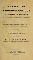
- Books
- Online
Conspectus chorographicus insigniorum locorum e geographia veterum populorum delineatus : accentus Graeci et syllabarum quantitatis diligentiore cura habita : in usum gymnasiorum / composuit A. Schroeder.
Schroeder, A. (Andreas)Date: 1831- Books
- Online
New geographical tables. Exhibiting at one view all the empires, kingdoms, states, republics, provinces, title, position, situation, extent, climates, boundaries, sub-divisions, square miles, cities, chief towns, coronation places, villages, latitude, longitude, bearing, forts, ports, oceans, seas, gulphs, bays, streights, islands, isthmuses, capes, promontories, rivers, lakes, mineral waters, mountains, numb. of inhabit, languages, religions, fom of government, patriarchates, archbishopicks, bishoppricks, universities, academies, Ord. of Knighth, commodities, productions, curiosities, &c. In Europe, Asis, Africa, and America: including an authentic list of all the countires, cities, and boroughs, of great Britain and ireland which return members (and what number) to their respective houses of parliament. To which are prefixed, I. Directions for the use of the globes geographical definitions, climates, horary circle, and grand division of the world, on a new plan. II. Chronological tables of the sovereigns of England, Germany, France, Spain, Russia, Denmark, and Sweden, from the year 768 to 1775. With a list of unihabited islands, ruins of celebrated place, countries and places known by different names, and ancient names of remarkable seas and rivers, in the appendix. By John Povoleri.
Povoleri, Giovanni.Date: MDCCLXXV [1775]- Books
Dictionnaire interprète-manuel des noms latins de la géographie ancienne et moderne. Pour servir à l'intelligence des auteurs latins, principalement des auteurs classiques; avec les désignations principales des lieux / [Anon].
Chaudon, Esprit Joseph, before 1738-1800.Date: 1777- Books
- Online
A compleat history of Oxfordshire. Containing, 1. The geographical description of the county in alphabetical order. 2. The ecclesiastical history. 3. The civil history. 4. The natural history, 5. The literary history. 6. The antiquities. 7. A map of the county. 8. An account of the gentlemens seats; a table of the names of all the towns and villages, &c. with the value of the livings: also a scheme of all the market-towns, &c. their distance from London, and from one another &c.
Date: M.DCC.XXX. [1730]- Books
Lexicon of the Greek and Roman cities and place names in antiquity, ca. 1500 B.C. - ca. A.D. 500 / ed. by K. Branigan ; general ed., Adolf M. Hakkert.
Date: 1992-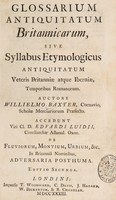
- Books
- Online
Glossarium antiquitatum Britannicarum, sive syllabus etymologicus antiquitatum veteris Britanniae atque Iberniae temporibus Romanorum. Auctore Willielmo Baxter ... Accedunt ... Edvardi Luidii ... de fluviorum, montium, urbium, etc. in Britanniâ nominibus, adversaria posthuma / [William Baxter].
Baxter, William, 1650-1723.Date: 1733
- Books
- Online
Glossarium antiquitatum Britannicarum, sive syllabus etymologicus antiquitatum veteris Britanniae atque Iberniae temporibus Romanorum / Auctore Willielmo Baxter. Accedunt ... Edvardi Luidii ... de fluviorum, montium, urbium, etc. in Britanniâ nominibus, adversaria posthuma.
Baxter, William, 1650-1723.Date: 1719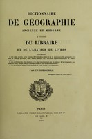
- Books
- Online
Dictionnaire de géographie ancienne et moderne a l'usage du libraire et de l'amateur de livres ... / Par un bibliophile.
Brunet, Jacques-Charles, 1780-1867.Date: [1870]- Books
Orbis latinus : oder, Verzeichnis der wichtigsten lateinischen Orts- und Ländernamen / von dr. J.G. Th. Graesse. Ein Supplement zu jedem lateinischen und geographischen Wörterbuch.
Grässe, Johann Georg Theodor, 1814-1885.Date: 1922